Sometimes the Brewster Conservation Trust finds some important open space right on Main Street. Other times, it is in some obscure corner of town. This was the case in January 2012 when we bought Theresa Ward’s 2.6-acre woodlot for its assessed value of $24,600. Ms. Ward’s family, the Browns, had owned this piece for generations; her grandfather John Bonnell bought it in 1923.
The forested parcel, thick with pitch pines, white and black oaks and huckleberry bushes, lies tucked into the southeastern corner of Nickerson State Park, close to Route 6. It is a long drive in to the end of the Park road system and then a half-mile hike to reach this parcel. As the old New England saying goes, “You can’t get theah from heah.”
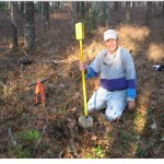
But BCT’s intrepid volunteers visited it several times over the fall and mild winter in order to find all the concrete bounds for the property’s corners. The last missing link was the pesky NE corner bound, buried beneath the surface in the middle of look-alike woods. Peter Soule, principal of Soule Land Surveying, who just happens to be a founding BCT Trustee and our treasurer, took some GPS coordinates and his “magic wands” and a little luck and came up with the marker.
In our business, this is like finding buried treasure, knowing where a bound is on the ground. It helps us to ensure that there are no encroachments on land we intend to preserve.
As you can see from the linked map, the Ward parcel sits with one edge on an old dirt road east running from Higgins Pond in the Park. The deeds describe this cartpath as “leading to John Kenrick’s house in South Orleans.” In the 1800s, John Kenrick’s home on what is now Rt. 28 in Orleans, was the only one for a long time and a real landmark. Most of this southeast area of Brewster was connected to Orleans’ farm families, rather than to Brewster’s. When the Mid-Cape Highway was finished in the late 1950s, even the casual backwoods linkage to Orleans was severed, and this area around the periphery of Nickerson State Park became unknown and unloved, except to explorers.
Ironically, however, these old woodlots around the edge of Nickerson State Park are more “natural” than much of the 1700-acre Park itself. You can see this clearly along the common boundary between the Ward parcel and the Park. On one side (Park) is a standing plantation of dead wood–southern red pines planted in rows by the Civilian Conservation Corps on the State’s land in the 1930’s Depression. A blight called Diplodia (Sphaeropsis sapinea) has killed large stands of the red pines. But on the Ward side of the line, which regrew naturally with pitch pines and oaks, there is no blight.
We celebrate the preservation of another small, good forest.


